A Whiteparish local history page from younsmere-frustfield.org.uk
Highlands Way is an estate created in three stages between about 1980 and the late 1990s, northeast of the centre of Whiteparish village and accessed through Green Close.

Kingsgate, the extension to Highlands Way built in the 1990s
viewed from Dean Lane, north of Alderstone House, looking south, July 2005
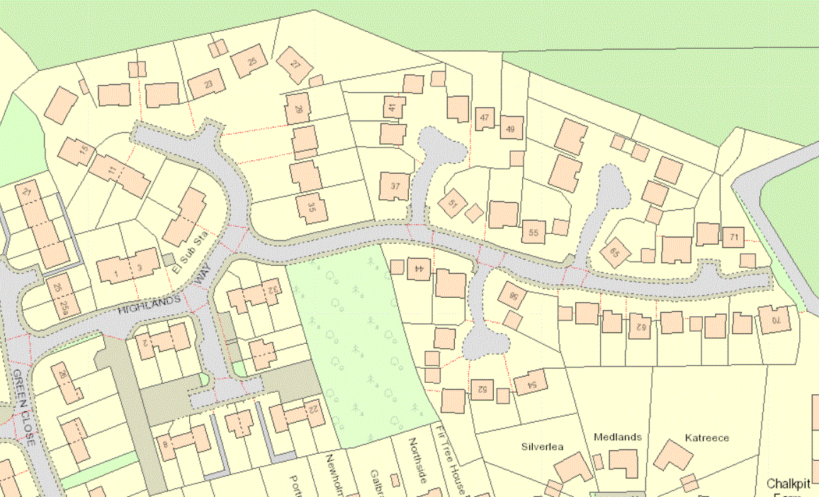
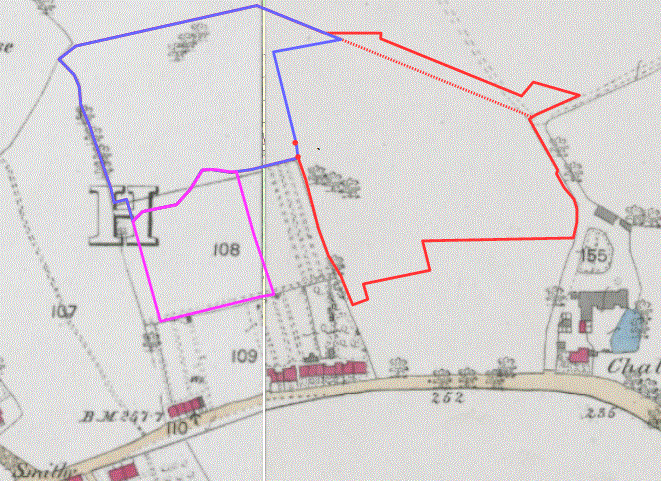
The map below shows the phases of development, starting with odd numbers 1 to 35 in the 1980s, branching off the end of Green Close (boundary in blue, planning approval 1979). The Kingsgate development was added in the 1990s (approval 1998), with the boundary shown in red and the two brick pillars marking the "estate" entrance marked as red spots. These pillars are still there and are visible in the photograph below. This added odd numbers 37 to 71 and even numbers 44 to 70. The third phase, with a magenta boundary, consisted of the low cost social housing [date?], even numbers 2 to 32. The 'copse' was intended to be developed as well, but local views prevailed and it was cleared and replanted with trees and shrubs, with a path running round it. Even numbers 34 to 42 are unused, presumably reserved to allow for any future development of this area. The red dotted boundary shows the original extent of the Kingsgate estate, with the additional piece of land there added in 1998 by purchasing part of the adjoining field and dividing it between the gardens backing onto it, resulting in two very odd shaped plots at the east end near the track to the Pains firework factory.
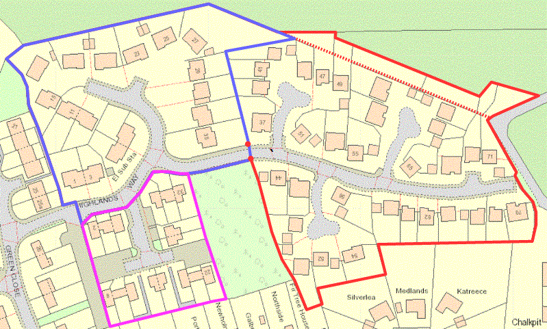
The original road (odd numbers 1 to 35) built in the 1980s [reference: the book Whiteparish 100 years], with the Kingsgate extension (odd numbers 37 to 71 and even numbers 44 to 70) in the 1990s and the low cost housing (even numbers 2 to 12 and 22 to 32 in ?....?).
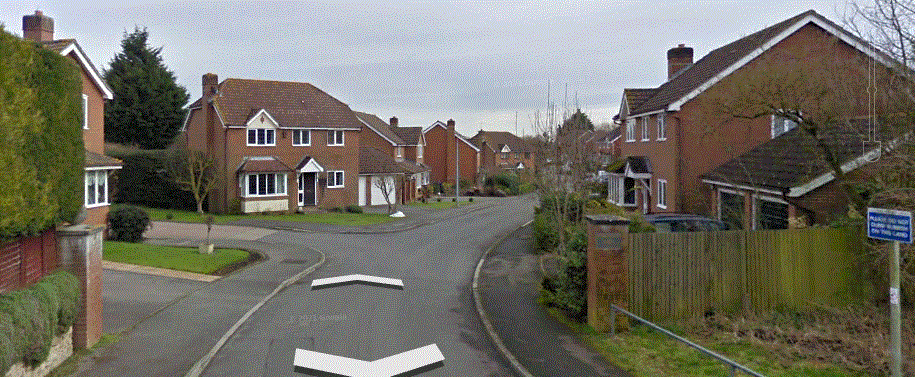
The posts marking the entrance to the Kingsgate extension of Highlands Way
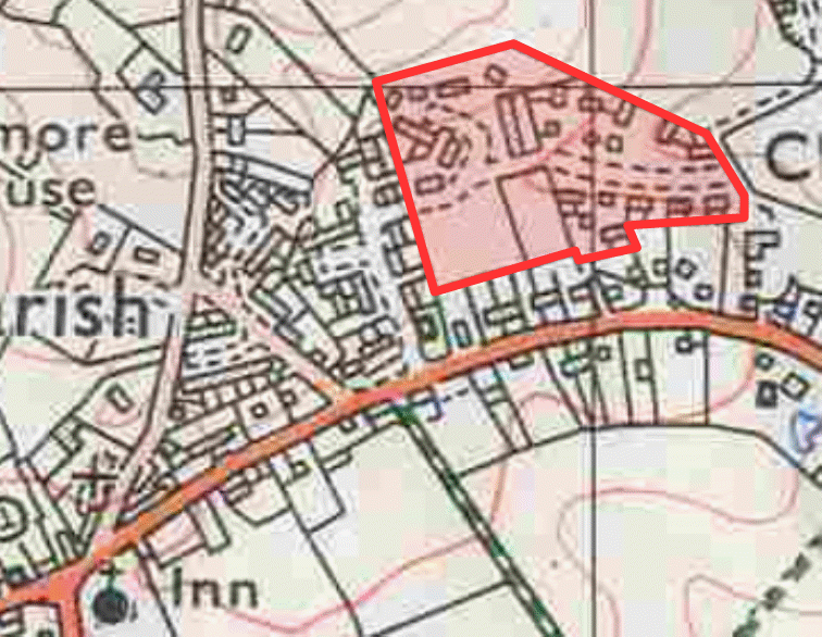
The land Highlands Way sits on was originally part of Blaxwell Manor. The manor was divided between his five sisters when William Noyes died between 1622 and 1632, the land north of what is now the A27 becoming Legges Farm, now Chalkpit Farm. This was owned by George Yalden Fort in 1842, and the map below shows the extent of his land holding in green.

Chalkpit Farm in 1842 - the map below shows how Highlands Way fits onto this area
This is one area of the village where less of the 1842 features line up with modern ones, as seen on the tracing below over the 1842 Tithe map, but several of the edges of the Highlands Way development do line up with this earlier map. In particular, the houses on Romsey Road define the southern boundary of part of Highlands Way, the social housing and copse occupy what was labelled as 'part of Home Field', and the east and west boundaries of the modern development follow pre-1842 field edges. The less precise surveying accuracy of the 1842 map explains the slight divergences in the boundary lines, which have been traced and transferred from modern maps without attempting to adjust them to the earlier map.


The site of Highlands Way overlaid on the map of 1842
The right hand map has been rotated to align with the other maps below - note that surveying accuracy is less precise
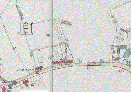
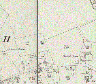
The next map gives an indication of how Highlands Way relates to the layout of the area in 1876. The social housing and copse occupy what was then a small field, area 108 on the map. The remainder of Highlands Way stands on the south edge of the open area 151, which stretched north to Dean Lane at Ashmore Pond (check - was this the area of Pond Close, Cowleaze, Home Field, Carpenters and The Little Field on the 1842 map?)
The site of Highlands Way overlaid on the map of 1876 [1:2500 OS map]
The last two maps here are of 1901 and 1924 (survey dates). The field boundaries have changed little since 1876, except for the addition of a fence running west from the right angle bend in the Pains Firework factory access road by 1924. This boundary isn't reflected in the later development of Highlands Way. There are progressive changes in the houses and buildings along Romsey Road to the south of Highlands Way.

The site of Highlands Way in 1901 and 1924 [1:2500 OS map]
In modern times the site now occupied by Fir Tree House and Northside on Romsey Road was redeveloped. There was a property there called 'The Bungalow' with planning permission granted in 2000 for its demolition and replacement by the two houses that are there now. Here the garden of 50 Highlands Way occupies part of what might logically have been the garden of Fir Tree House and I have often wondered whether The Bungalow had been purchased earlier to allow this, or possibly in the hope of providing a direct access from the A27 to the Kingsgate development of Highlands Way.
I've since had it confirmed [March 2024] that it was intended that the access road to Highlands Way would pass through the plot occupied by The Bungalow and then what is now number 50 Highlands Way. The Council refused permission for this, resulting in all the traffic having to be routed along Green Close, much to the annoyance of the residents of that road. Redevelopment of the site of The Bungalow took place well after Kingsgate had been completed. The private page Highlands Way References contains full details and thanks for this information.